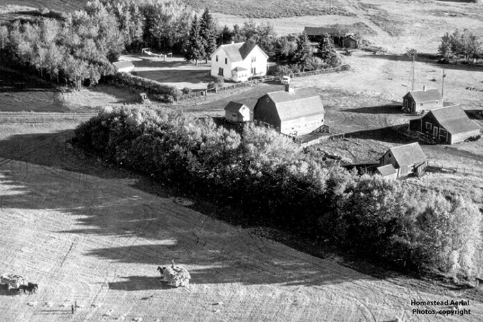
A chance to find vintage aerial images of family farms from across the Southwest will be provided in Swift Current on June 17 and 18.
Homestead Aerial Farm Photos will be set up at the Wheatland Mall Main Entrance this Friday and Saturday with a selection of archival aerial farm photos dating back to the 1950s, along with newer photos take in the 70s, 80s and some in the 90s.
Homestead Aerial Farm Photos owner Kim Bessette is stopping in Swift Current before heading to Canada’s Farm Show for a three-day exhibition.
Bessette noted that aerial images are popular in helping connect a new generation with their farm roots, as well as for treasured keepsakes for individuals who grew up on those farms.
He shared that one recent photo find of a farm a customer’s grandfather homesteaded helped uncover some forgotten memories of the property.
“He did recognize one building in the yard, the house that he lived in, but he didn’t realize that there was an older house there too…and an older barn was already gone by the time he remembered,” Bessette said.
“He was quite amazed that those building were still in the photo. So it didn’t take much of a decision that he would like to have a nice high resolution copy of that reproduction.”
Also, many of the photos from the 50s have people out in the yard working, and they stopped what they were doing to wave at the low flying airplane that flew over their properties.
“That always adds to the interest in the old farm photos especially when there are some family members that are caught in the photo of when it was taken.”
Bessette explained that photo searches are most successful with an exact legal land description.
“If they get the legal land description that’s the easiest, but they still need to kind of have an idea of what they’re looking for.”
Photos can also be searched for through directions to the farmyard, or the name and area of the landowner.
“All they need to do is come and show me on the map first where the farm is located. If they don’t have the legal land location all they’ve got to do is show me is how to drive out to the farm from the nearest community.”
Once Bessette identifies close to where the farm is located, he hands the customer a selection of 40 proof images which features the farmyards photographed during one flight pass.
“So then I’m going to give them a pack of photos and they’ll just flip through that until they find the farm.”
This process is helpful as they will see neighbouring farms and familiar properties while searching for the right image.
For people who are a generation or two removed from the farm, photo searches can be successful by searching for homes or barns.
“If they don’t know what the old farmyard looked like, maybe they bought a farmyard from somebody that’s not even their family, see if you can bring us in the original owner’s first and last name because a lot of those names are on the backs of the proofs.”
“Some people will bring in a picture of the house that was there or the barn. It doesn’t have to be an aerial photo, just any photo of any buildings that were in that farmyard then we can use that for reference and match it up.”
Additional information is available by visiting www.homesteadaerial.com or contacting Bessette via email at homesteadaerial@gmail.com.


